|
|
|
Cruise Port Guide
|
|
|
|
| US Virgin Islands - USVI Travel Guide |
|
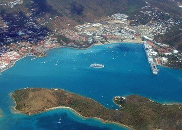
Welcome to US Virgin Islands on the Paradise Islands website. The USVI consist of three large isles of which the main one is Saint Thomas with it's capital Charlotte Amalie; a busy working port and one of the most popular cruise stopovers in the Caribbean.
Charlotte Amalie was named after a Danish Queen and the town has the best shopping opportunities in the USVI on the busy main street which full of quaint stores, together with the colourful harbour front lined with old Danish buildings. The other two large isles are Saint Croix and Saint John. |
| There are seven main isles within the whole VI group which are divided in ownership between the United States (St Thomas, St Croix and St John) and the British (Tortola, Virgin Gorda, Jost Van Dyke and Anegada). The US and British Virgins lie just a few miles apart and around 90 miles east of Puerto Rico within a larger group known as the Caribbean Leewards. The USVI covers an area of some 134 square miles with a population of around 110,000. |
|
Aerial photograph of Charlotte Amalie
|
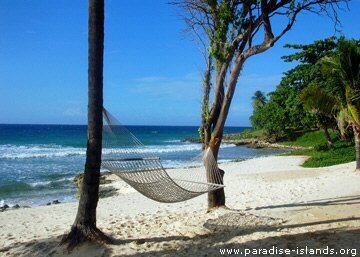
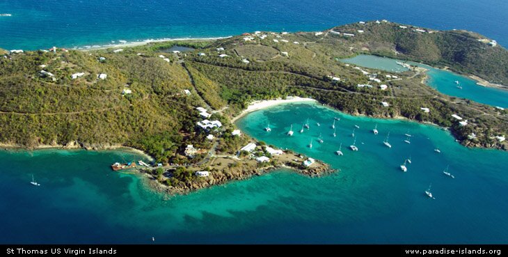
Tranquil beach scene on Saint Croix
|
|
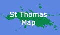
The most well known of the USVI is St Thomas (population 51,000) which is a major port of call for most cruise lines operating in the Caribbean as well a tourists arriving by air at the Cyril E King Airport. The airport acts a hub for all of the VI chain with connecting flights to many US cities and routes around the World. Notable landmarks include Magens Bay, Blackbeard's Castle, Buck Island National Wildlife Reserve and Fort Christian.
Saint Croix is actually the largest of the USVI (28 miles long and 7 miles wide) and lies 36 miles south of Saint Thomas. Saint Croix has two main towns, Christiansted and Frederiksted and a population of around 53,000.
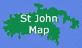
Saint John is the smallest of the main three USVI and lies just 4 miles east of Saint Thomas; covering an area just under 20 square miles with a population of 4,000. Serviced by a regular ferry from Charlotte Amalie (every hour to Cruz Bay); the island is a popular day trip for cruise passengers. Most of Saint John is under developed and a National Park with many notable landmarks including the world famous Trunk Bay.
|
|
|
| The region was discovered by Christopher Columbus in 1493 and named after Saint Ursula and her many followers. The US Virgin Islands have been under various European control over the years including the British, Spanish, French and Danish. The Danish settled in 1672 and held control until 1917 when a sale was agreed to the US Government and United States citizenship was granted to the islanders in 1927. |
| Travel, cruise, vacation and cruise guide to the United States VI and the Caribbean. All text and images are Copyright Paradise Islands org. All photographs on this Caribbean travel guide website are obtained with the permission of the owners and come from various sources including the local tourist boards. Some of our own maybe reproduced with permission - please see notes attached to each image to avoid any copyright penalty. |
|
|
|
|
|
|
|
|
|
Quick Facts
Capital
Charlotte Amalie
Main Airport
Cyril E King
Main Port
Charlotte Amalie
Language
English
Currency
US Dollar
Government
Unincorporated
Organized US Territory
Island Size
134
Square Miles
Population
110,000
|
|
|
|
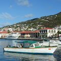
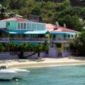
Charlotte Amalie
|
|
|
|
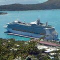
Cruise Port
Saint Thomas
|
|
|
|
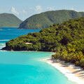
Cruz Bay Saint John
|
|
|
|
Trunk Bay St John
|
|
|
|
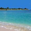
Buck Island
St Croix
|
|
|