|
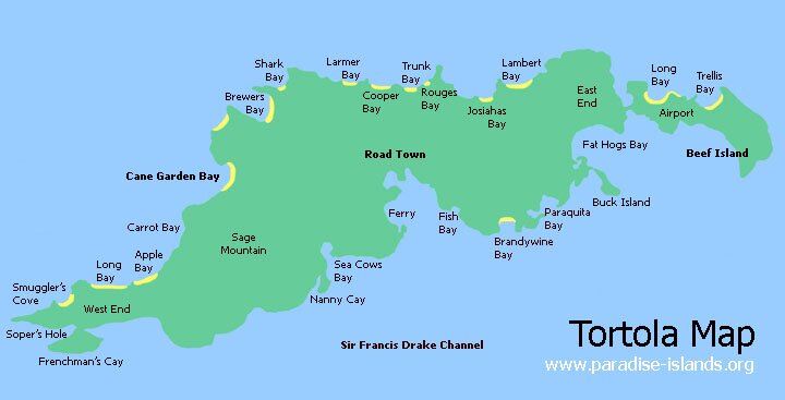
Want to use the Tortola map above (top)? Paradise Islands grants permission for the map of Tortola to be copied or downloaded for personal use, school projects, within blog entries or forum chat posts without requesting permission from the copyright owner (please place a courtesy link to this site or this page, thank you, see below). Paradise Islands does not grant permission for the map of Tortola to be used for general and commercial website illustration.
Map copyright Paradise Islands 2007. All rights reserved.
Print this map? Click this link for the JPG file (720 x 367 pixels): Tortola Map (opens in new window)
Link to this page? Please use this page URL: http://www.paradise-islands.org/tortola/map.htm
Link to the map JPG file? Image URL: http://www.paradise-islands.org/tortola/images/Tortola-Map1.jpg
|


