| The islands of Guadeloupe are made up of five islands: Basse-Terre and Grande-Terre (which are joined by a narrow strip of land), La Desirade to the east and Les Saintes and Marie-Galante to the south. The islands cover an area of 1,434 square km. The largest island of Basse-Terre has a volcanic mountainous interior and it's adjoining neighbour of Grande Terre is flatter with a number of tourist beaches. |
|

|
|
Want to use this map? Paradise Islands grants permission for this image to be copied or downloaded for personal use, school projects, within blog entries or forum chat posts without requesting permission from the copyright owner (please place a courtesy link to this site or this page, thank you, see bottom of page below).
Paradise Islands does not grant permission for this image to be used for general and commercial website illustration.
Copyright Paradise Islands Caribbean Travel Guide. All rights reserved.
Print this Image? Click this link to the JPG file (740 x 604 pixels): Guadeloupe Map (opens in new window).
Having trouble printing? This is a large file which may not fit your printer paper. Try saving the image as a JPG file to your 'my pictures' or 'my documents' and then re-size to fit.
Link to JPG file? Image URL: http://www.paradise-islands.org/guadeloupe/images/guadeloupe-map.jpg
|
|
Interactive Satellite Image
Use the "+" or "-" buttons to zoom in or out
|
|
|
It is within the Caribbean Leeward island chain and positioned half way between Antigua (due north) and Dominica (due south). Another close neighbour is Montserrat (to the north west).
The local languages spoken are French and a native French Creole. English is rarely spoken and most visitors come from France. Average daily temperatures in January are 28'C (82'F) and the popular tourist season runs from early December until the end of May when rainfall is low and the temperatures are the most comfortable.
The Le Raizet Airport is just a few miles north of Pointe-a-Pitre on Grande-Terre and international flights operate to and from Paris, Miami and Montreal. Local inter-island flights operate to and from Saint Barthelemy, Fort-de-France in Martinique, Ceyenne in French Guiana, Antigua and Sint Maarten. |
| Travel, holiday, vacation & cruise guide to the Caribbean. All text and images are Copyright Paradise Islands org. All images on this website are obtained with the permission of the owners and come from various sources including tourist boards. |
|
|
|
|
|
|
|
|
|
|
|
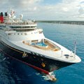
Cruise Port Guide
|
|
Some of our favourite
Caribbean destinations
|
|
|
|
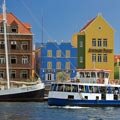
Willemstad
Curacao
|
|
|
|
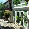
Old San Juan
Puerto Rico
|
|

|
|
The Pitons
Saint Lucia
|
|
|
|
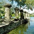
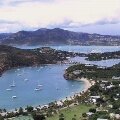
Nelson's Dockyard
Antigua
|
|

|
|
Trunk Bay
St John USVI
|
|
|
|
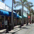
Philipsburg
Sint Maarten
|
|
|
|
Shirley Heights
Antigua
|
|
|
|
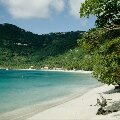
Cane Garden Bay
Tortola BVI
|
|
|
|
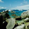
The Baths
Virgin Gorda BVI
|
|
|
|
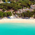
West Coast
Barbados
|
|
|
|
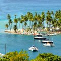
Marigot Bay
St Lucia
|
|
|
|
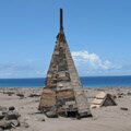
Buried Plymouth
Montserrat
|
|
|