|
The island is located nearly one hundred miles east of the most of the other Windward islands and around sixteen hundred miles southeast of Miami, Florida. It is a flat coral island compared to most of it's neighbouring Caribbean islands which are volcanic. It's closest neighbours are St Lucia and St Vincent.
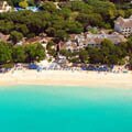
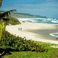
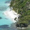
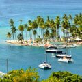
Barbados is twenty one miles long and fourteen miles wide (the total area is some one hundred and sixty six square miles). The capital is Bridgetown and the island has nearly seventy miles of sandy beaches, many of which are detailed on the map above.
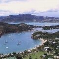
The main tourist area is located on the west coast between Speightstown in the northwest and Bridgetown in the southwest with another pocket of tourist developments on the south coast between Oistins and the airport.
|